>Zell am Ziller Piste Map Skiing and Snowboarding around the Ziller Valley
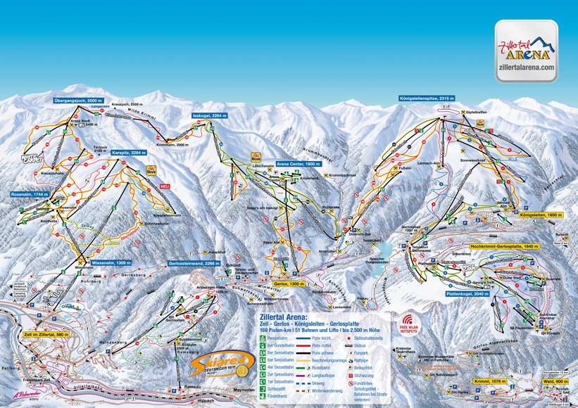
The Zillertal Arena piste map showing the connected ski resorts of Zell am Ziller, Gerlos and Königsleiten and the nearby town of Krimml where you can see the highest waterfalls in Europe.
The terrain is ideal for beginners and intermediate skiers plus there are some very challenhing blacks and off-piste for the more advanced skiers and boarders. In total, there are some 160km of pistes to explore.
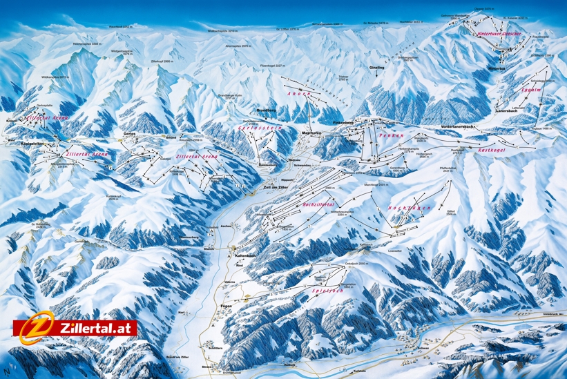
If you fancy skiing in some of the other areas in the Ziller Valley, there is a wide choice of ski resorts including...
- Gerlos
- Fugen
- Tux-Finkenberg
- Hintertux Glacier at the top of the valley where you can ski 365 days a year!
| Piste map information | |
|---|---|
| Black | 10 |
| Red | |
| Blue | 7 |
| Beginner areas | 4 |
| Drags | 17 |
| Chair | 21 |
| Gondola | 8 |
| Cable car | 1 |
| Funicular | 0 |
| Railways | 0 |
| Slope direction | N, E |
| Mountain restaurants | 37 |
Zell am Ziller Trail & Ski Area Map


