Arapahoe Basin Trail Map Skiing and snowboarding in and around Arapahoe Basin, Colorado
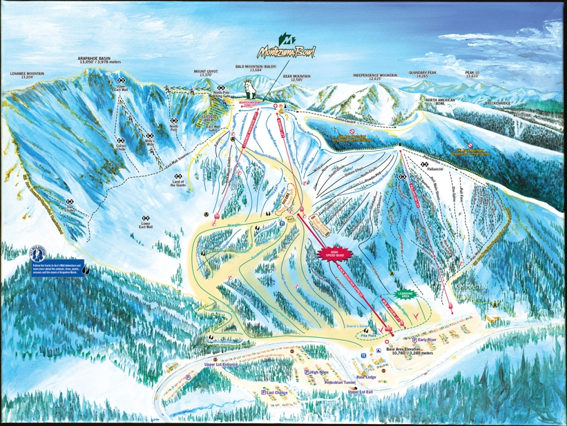
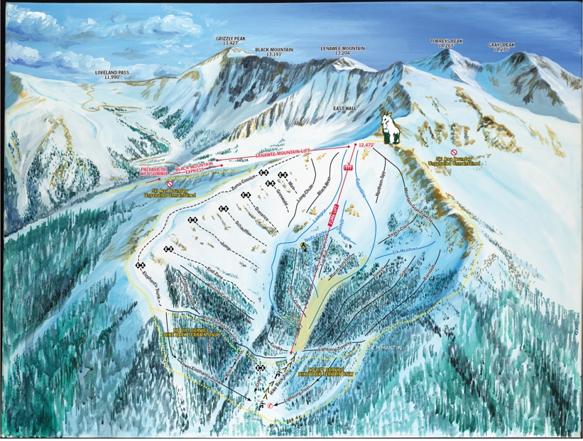
The trail map of the Arapahoe Basin ski area shows how extensive the terrain is. From the beginner areas on the lower mountain to the steep chutes and trails on the East side of the upper mountain - known as the East Wall - there is something for everyone no matter what level.
The ski area is divided up as follows...
- Beginner: 10%
- Intermediate: 30%
- Advanced: 37%
- Expert: 23%
For off-piste skiing, there are 3 backcountry access points from the Arapahoe Basin Ski Area where you can experience some breathtaking riding in pristine natural beauty. As always, a guide is recommended as these are unpatrolled areas.
| Piste map information | |
|---|---|
| Black | 26 |
| Red | 39 |
| Blue | 33 |
| Beginner areas | 11 |
| Drags | 2 |
| Chair | 6 |
| Gondola | 0 |
| Cable car | 0 |
| Funicular | 0 |
| Railways | 0 |
| Slope direction | N,S,E,W |
| Mountain restaurants | 4 |
Arapahoe Basin Trail Map


